Point Cloud Survey
PLEASE NOTE – SolidCapture is a trading name for SolidPoint Ltd. As SolidCapture is a new venture, we will only be accepting work that is within a 25 mile radius of Derby until further notice.
In a world driven by data, the precision and comprehensiveness of that data become paramount. Enter the realm of Point Cloud Surveys, where every detail of a physical environment is captured with unparalleled accuracy.
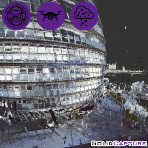
A Point Cloud Survey involves the use of advanced laser scanning technology to capture millions of data points from a physical space or object. These data points, when visualised, form a ‘cloud’, offering a 3D representation that’s rich in detail and depth. Whether you’re an architect, engineer, developer, or historian, Point Cloud Surveys provide a digital twin that’s almost indistinguishable from the real thing.
Here at SolidCapture, our commitment to technology and precision places us at the forefront of the Surveying industry to deliver consistently reliable and accurate point clouds. With state-of-the-art equipment, a team of skilled professionals, and a passion for excellence, we ensure your project’s data is accurate, comprehensive, and actionable.
The Process:
- You place an order for our service/s and complete a short form with a few details
- We will contact you for any more details we may need, as well as answering any queries you may have
- Our expert team will visit your property and collect the data needed
- This data is then be processed in-house
- Everything gets checked over and you receive your final product.
From £714*
A Point Cloud Survey is a process that generates a collection of data points in a three-dimensional space using 3D scanners. This process is instrumental in accurately capturing the exact dimensions and form of physical entities, be it objects, environments, or sites.
The survey employs sophisticated laser scanning technology to gather millions of data points from a physical object or space. When these data points are visualised, they form a ‘cloud’, presenting a 3D model that is rich in detail and depth.
For professionals such as architects, engineers, developers, or historians, Point Cloud Surveys create a digital duplicate that is nearly identical to the original. Equally, for those wishing to conduct a building analysis or study the environment of their property, a Point Cloud Survey is essential in efficiently doing so.
As a bonus, we’ll give you and a neighbour an extra 20% off if you both purchase a drone survey with us! Contact a member of our team to learn more.
*Prices do not include VAT
Your Point Cloud Survey Will Include:
- All Point Cloud data
- 3 months of online hosting on our customer portal
You Can Use Your Point Cloud Survey For:
- Structural analysis
- Construction planning
- Urban planning
- Infrastructure inspection
- Industrial design
The Benefits of Choosing SolidCapture for Your Project:
- Time-Efficiency – Reduce site visits and fast-track your project timeline.
- Cost-Effective – Minimise costly errors and reworks.
- Safety – Survey hazardous or inaccessible areas without putting staff at risk.
- High Accuracy – Capture precise measurements, ensuring detailed and accurate representations of real-world structures or objects.
- Consistency – Offers a standardised method of data collection, ensuring consistent results regardless of the environment or conditions.
- Detailed Documentation – Provides a thorough digital record of sites or structures, valuable for historical preservation, future planning, or legal documentation.

